DISCLAIMER: This post was written in 2012. Information may be out of date!
Location: Ulu Bendul, Negeri Sembilan, Malaysia.
Start point: 2.727418N, 102.0758E 177m a.s.l. (Ulu Bendul) AND 2.727351N, 102.0562E 293m a.s.l. (Bukit Putus)
Summit: 2.698775N, 102.047788E 836m a.s.l.
Difficulty: Moderate easy. The Ulu Bendul trail is a little longer and has one fairly steep section (Botak Hill), otherwise both are standard jungle trails of average steepness.
Date climbed: 20 October 2012
Most of what I have read about Gunung Angsi seems to imply that the climb isn’t that interesting, and that Gunung Angsi lacks views. While there is some truth to this, Angsi is still a place I wanted to visit at least once. There are (apparently) 4 trails which lead up to the summit – via Bukit Putus, Ulu Bendul, a third trail I don’t know much about, and an apparently disused 4th trail. To see as much of Angsi as I could in half a day, we decided to take the Ulu Bendul route up, and return down via the Bukit Putus trail, and walk back along the road to our cars.
3 of us from PJ joined the Seremban climbing group that we hiked with up Gunung Ledang. We left PJ at 6.15am, and after a smooth drive, arrived at the Ulu Bendul recreational park at 7.30am. If you’re not into climbing, the recreational park is ideal for quite a number of outdoor activities such as camping, picnics, playing in the river (there’s a swimming pool of sorts filled with the river water), etc.
Before heading up the trail, we had to pay RM5 per person. Not the cheapest as I don’t believe there’s much maintenance needed on the trail, but fine. (If I’m paying money, I’d prefer a place like Gunung Datuk as they actually do have to maintain the ladders.)
The Ulu Bendul trail is definitely harder than the Bukit Putus trail, as it starts over 100m lower down, and is longer as well. The first 4km of the trail is pretty straightforward, and does not gain much altitude at all. We had to cross 2 small rivers, which some of us were able to do by hopping from rock to rock (which carries the risk of slipping and ending up with wet feet), while the others removed their shoes (safer).
Shortly after the 2nd stream crossing, the trail begins to climb continuously, although never really steep. The terrain was reminiscent of Nuang – wide paths and clay ground. About 2/3rds of the way up, we emerged at Botak Hill, an open area with steep sand boulders. There were ropes fixed along the left side of the climb, however, a few of us (me included) decided to use the right hand path, which although lacked ropes, looked like it had better footholds. (I tend not to trust ropes)
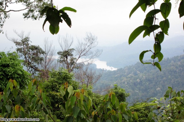
There’s a final steep climb after the rope section after which we emerged at the summit, about 840m up. There weren’t any “spectacular” views from the top, but we could see Seremban to the west, and more hills to the east. The journey up took us 2hr 50min at a relaxed pace, while going down the Bukit Putus trail took us about 1hr 30min. Along the way down, we passed by Panjang’s Rest Area, where there’s a good number of chairs to relax on, and one of the locals apparently gives out refreshments there, though no one was there on the day we climbed.
After we reached the start of the Bukit Putus trail, we walked back along the main road – 4km in total, which took us about 45 minutes.
For me, Angsi was more of a training climb, as I was carrying a lot more gear than I normally would (about 11kg in total). I didn’t expect any great views (and as expected, didn’t get many), but it was still an enjoyable climb with good company. If you’re planning to visit Gunung Angsi only once, I do recommend trying both trails as it gives you some different views along the way (i.e. Bukit Putus trail has some open views, while Ulu Bendul has some streams/rivers).
Photos


GPS Details
Download GPX, KMZ (Google Earth)
View on EveryTrail (interactive map)
Duration: 5 hours 10 minutes
Length: 13.5km
Average Speed: 2.6km/h
Max elevation: 838m
Min elevation: 135m
Vertical Up: 910m
Vertical Down: 909m
Preparation
Notes:
- RM5 climbing fee
- You may not be allowed to climb if you start late in the day (**unconfirmed**)
- 2 stream crossings, for which you might have to remove shoes
- Rain protection is recommended for any electronic items or clothing.
- Moderate number of leeches
- If you are prone to chaffing, apply vaseline/bodyglide/etc. as necessary.
- Hiking stick is optional (may get in the way while climbing ladders/ropes), but can help on the way down
Checklist:
- Minimum 2L fluid, isotonic recommended.
- High energy snacks/lunch
- Hiking shoes & extra socks for comfort, if you need
- Raincoat/poncho
- Small towel (for sweat/etc.)
- Insect Repellent
- Small plastic bag to keep electronics dry in rain
- Extra clothes (both shirt & pants), can leave in car
- Plastic bags for dirty shoes/clothes, can leave in car
- Slippers/Sandals to change into afterwards if shoes are muddy
- Gloves (while climbing ropes)
- Emergency gear: flashlight, whistle, knife, lighter, 1st aid kit, etc.
- Optional: cap/hat, tarp/flysheet, cord/string, mat, water filter/tablets, etc.
(See my personal packing list here)


thks for the great info – i will climb it this saturday , alone
been there again sept 2014 . climb through b putus , finishing at ulu bendol then walking to my car the same 4km . solo climb again .
may i copy your map photo..tq
Thank you for an excellent trip report. Your notes and map is invaluable to those contempting climbing Gunung Angsi.
Thanks for the trail map. Initially I wanted to use the Ulu Bendul trail but after looking at the map, would do the Bukit Putus trail instead.
Is there any landmark or office to mark the start of the Bukit Putus trail?
Good trip report, thank you. I used this to research my recent trip.
I would recommend going one way via Bukit Putus (4.1km) and the other via Ulu Bendul (7.4km) – the Ulu Bendul route is longer/harder but has some beautiful cascades and fun “climbing” sections with rope. Didn’t encounter any leeches 🙂
Took 5 hours for the round-trip, and saw only two other people on a weekday. Full trip report: https://hikingtheworld.blog/2017/08/17/gunung-angsi/
How far it’s from KL?
Great post, Instagram is such a Powerful tool.
I know that getting followers is very hard, that’s why services like
gramgenius.com really helps you to get more followers.