DISCLAIMER: This post was written in 2012. Information may be out of date!
Location: Taman Melawati, Kuala Lumpur, Malaysia.
Start point: 3.232641N, 101.749952E 85m a.s.l.
End point: 3.232116N, 101.75739E 345m a.s.l.
Difficulty: Very high risk, moderately difficult. Short, easy in terms of strength/endurance needed. However, very steep slopes (60-80 degrees), rocky terrain and vertical drops increase the risk and “scare” factor. Not recommended for people afraid of heights.
Back in May 2012, I climbed Bukit Tabur West with 2 of my friends. I never got around to blogging it, but while researching Tabur West, I also read a fair bit about the slightly more elusive Tabur East. It’s been quite a while since then, but I finally managed to make a trip to Tabur East.
Opinions on Tabur East tend to vary, with some saying it’s more difficult than Tabur West, and some saying otherwise. Regardless, the terrain is very similar to Tabur West, with similar techniques and care needed while climbing. The trail itself is shorter than Tabur West, but I think the slopes are slightly steeper (and go on longer).
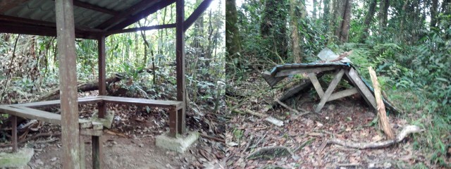
The start of the hike is along the road with 2 big pipes running parallel to each other (see on Google Maps). After parking, this is the sight which greeted us:

Walking down the road, there is a small bridge which crosses a small river, after which the tarmac road ends. The trailhead is just a bit further (following the big pipes), on the right hand side. It’s marked clearly by a “Dilarang masuk tanpa kebenaran” (No entry without permit) sign, which we entered.

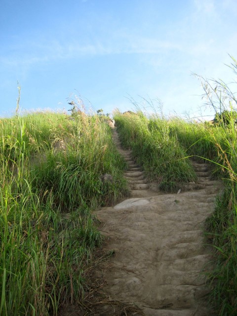
The trail is immediately steep uphill, first through jungle terrain (sandy/soil ground), which is slowly replaced by rocky ground. Within 10 minutes of climbing, we reached the rope sections. (I do not recommend you use the ropes unless you have to – rocks almost always provide better grip, and they don’t swing around. Only use the ropes when there are no rocks to grip, or if you really need extra stability!
Shortly into the climb, there is a viewing point of KL and the dam, which I don’t recall being able to view from Tabur West (However, I climbed Tabur West in the dark, so I may be wrong).


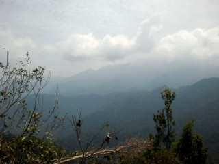
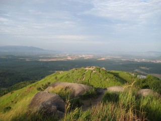
After being stuck behind a group of about 10 people for 20 minutes, we decided to overtake them. Another piece of advice: find a safe place to overtake, and let the group know beforehand. Don’t pressure them to move faster than they are comfortable with! Not long after that, we emerged into more open terrain. There was no lack of viewing spots, providing great views of KL, forest, mountains and much more. Some photos:


Once on the ridge, the climb towards the summit didn’t take long. It involved going both up and down, over rocky area and through a short jungle section. Right before the summit is a junction – one apparently leads out (we didn’t take this path), the other leads to the final ascent: a steep and long 60-80 degree long section with ropes along the whole way. Again, I do not recommend the use of ropes unless they are really needed! It took us about 10 minutes to scale the last section, after which we emerged at the beautiful summit. The weather was beautiful, although it did make it really hot, with a scorching sun at only 10am! Here are some panoramas I took (click to view full size):


Just a few minutes further on, we came to the end of our journey, our progress halted by a high vertical cliff, impassable to any (except with climbing gear, perhaps).

Further peaks are visible – apparently they can also be climbed, if you google Tabur Far East/Tabur Extreme Far East/etc.. Perhaps I’ll try climbing them one day?

Also visible for much of the climb were quartz formations. They were far more plentiful than when climbing Tabur West

We returned the same way we came from. In total, we ran into about 30 other climbers that day. Also, when we got back to our starting point at noon, the heavens opened and poured a TON of rain. I hope the other people who were still climbing were safe!
Tabur East is a good training ground if you want challenging terrain but lack time, as it’s very close to PJ/KL. In fact, my muscles ached a bit the day after (more so than when I climbed Bukit Kutu/Gunung Nuang/etc.), probably because of the much wider range of motion needed while climbing Tabur East – at some points the steps are extremely far apart! It’s not too challenging physically, but is much higher risk than any of the other mountains I’ve climbed in Malaysia. I have to say that I have not yet found any other place which is like Tabur, which offers an extremely interesting climb with stunning views. Just stay safe if you decide to go! And I mean that VERY seriously!
GPS Details (from start to furthest point)
Download GPX, KMZ (Google Earth)
View on EveryTrail
Duration: 1 hours 37 minutes
Length: 1.7km
Average Speed: 1.1km/h
Max elevation: 351m
Min elevation: 85m
Vertical Up: 311m
Vertical Down: 51m
Preparations
Warning: Difficult terrain!! Not recommended as a first hike or if you’re afraid of heights. Average hike time is 2-3hrs both ways.
- Good phone coverage
- No river crossings
- Much of the terrain is exposed. Cap may be useful if it’s very sunny
- Few/No leeches
Checklist:
- ~1.5 liters drink, isotonic recommended.
- High energy snacks
- hiking shoes (or shoes with grip), extra socks for comfort, if you need
- Raincoat/poncho
- Small towel (for sweat/etc.)
- Insect Repellent
- Small plastic bag to keep electronics dry in rain
- Extra clothes (both shirt & pants), can leave in car
- Plastic bags for dirty shoes/clothes, can leave in car
- Slippers/Sandals to change into afterwards if shoes are muddy
- Gloves (you’ll be on all fours a lot of the time. I ended up not using mine but they could definitely help a lot)
- Emergency gear: flashlight, whistle, knife, lighter, 1st aid kit, etc.
- Optional: tarp/flysheet, cord/string, etc.


